One platform, many kinds of field response
Locate, triage, and dispatch
For any team that fields calls and sends help to a location.
A caller rarely knows their exact address. Beacon turns “where are you?” into a single tap: text them a no-install link, and their precise location — plus a photo if it helps — lands on your map in seconds. Assess by priority, dispatch the nearest available responder, and let overdue-call flashing make sure nothing sits too long.
- Exact location, no spoken address
- Priority triage + overdue flashing
- Optional caller photo for size-up
- Every call logged for after-action
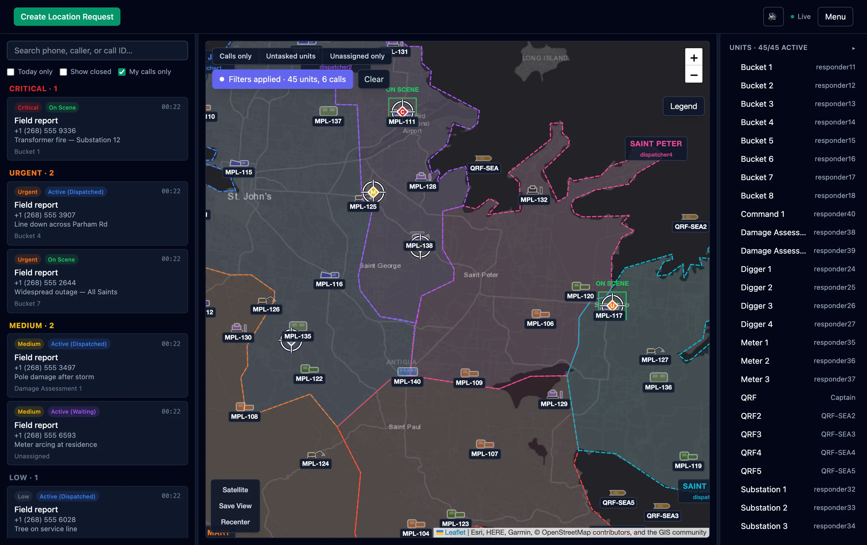
- Priority triage
- Overdue flashing
- Every call logged
Coordinate field teams at scale
For utilities, municipal works, and any distributed fleet.
Across a large service area, the shape is the same: work comes in, you triage by severity, and you send the nearest qualified crew. Beacon adds configurable vehicle and resource types, named service districts, areas of responsibility, and a mutual-aid cascade that identifies the next-best available team automatically when the first can’t take it.
- Configurable vehicle & resource types
- Named service districts
- Mutual-aid cascade
- Import a roster from one JSON file
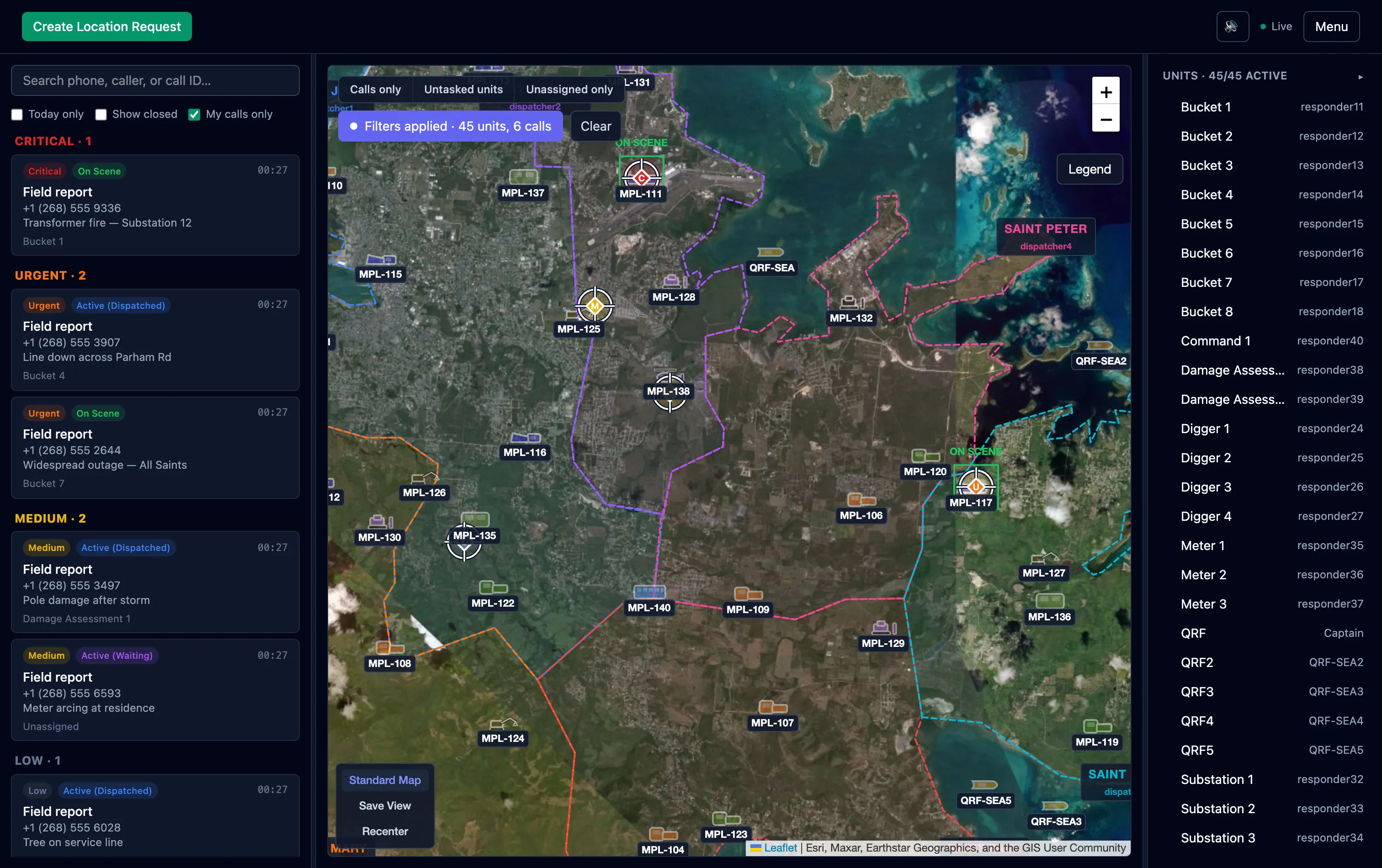
- Service districts
- Standard ↔ satellite
- Fleet classes
If it’s dispatched to a place, it fits
Campus & event security
Route the nearest officer to an incident with the reporter’s exact location.
NGO & field response
Coordinate teams across a region with no app to install for the people reporting.
Roadside & recovery
Locate a stranded customer instantly and dispatch the closest truck.
Municipal services
Triage service reports by severity and send the right crew to the right block.
Not sure how it maps to your operation?
Start a free workspace and try it with your own scenario, or tell us about your field response and we’ll walk you through it.
Free 30-day trial · No credit card · Cancel anytime